The Thredbo River used to be called the Crackenback River. The story went that this was country so steep that it would crack a man’s back if he tried to ride a horse through it.
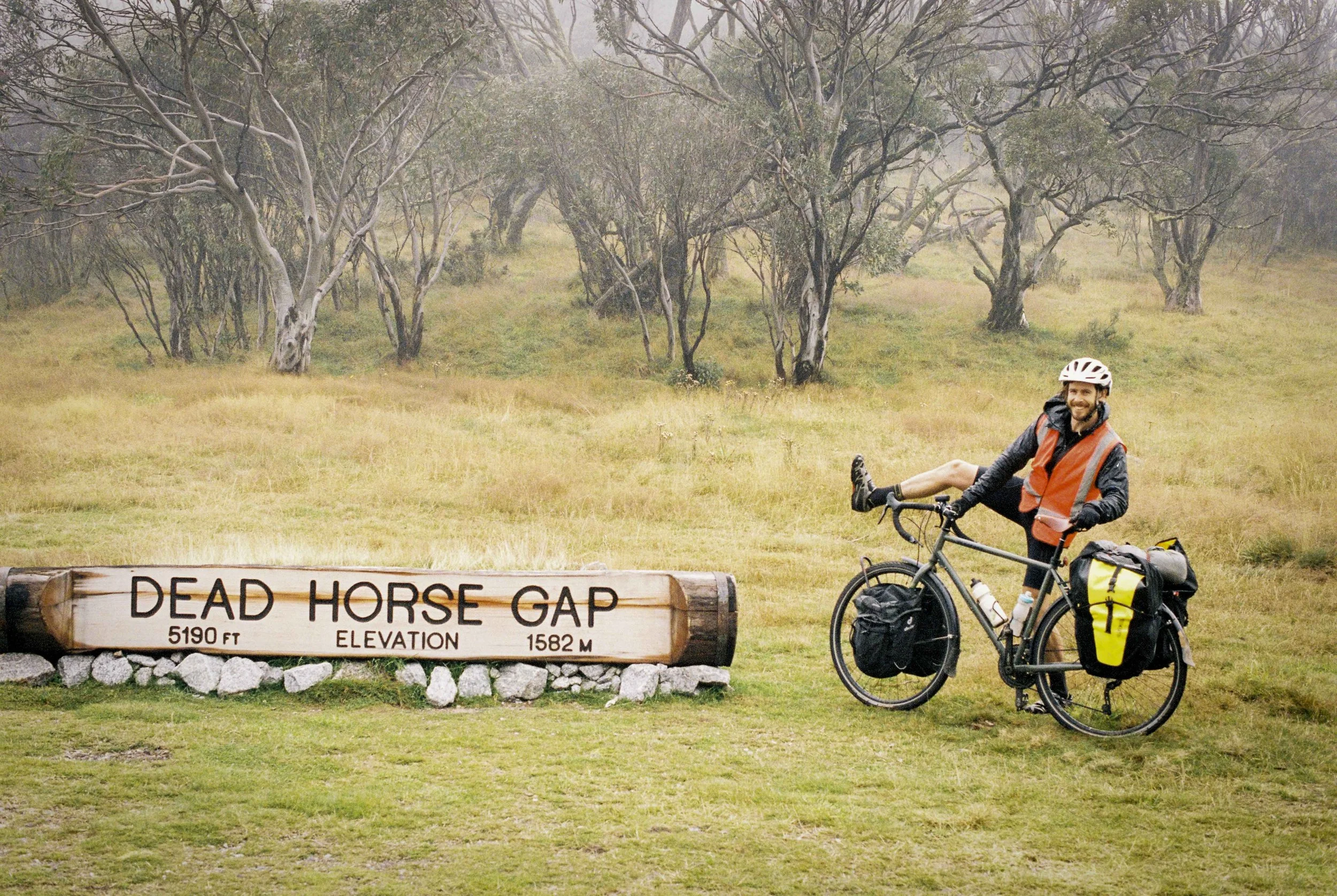
Pat Kirkby doing his best cowboy pose.
The head of the Crackenback River isn’t far from Mt Kosciouszko. Being the top of Australia, it is fitting that this section of the Great Dividing Range is named the Snowy Mountains. The tallest section of the Snowy Mountains is the Main Range of Mt Kosciouszko and is notorious for the coldest weather and deepest snow in Australia. The scoured alpine plateaus are no place to seek shelter from the wind.
The Alpine Way is a sealed road which connects Kanchoban to Jindabyne and reaches up to 1560m at Dead Horse Gap (the joke is, it was the climb that killed the horse). In sections, tall, orange snow poles mark the edge of the road. If the Alpine Way was not cleared in winter with snow ploughs, no one would be driving on it.
Brumbies abound on the high plains of the Snowy Mountains. There are at least two in this picture. ;)
We recently rode our bicycles from Hobart to Canberra with a good friend of mine, Pat Kirkby. Our journey took us across Tasmania’s Central Plateau, then the Yarra Ranges, the Victorian Alps, then into the Snowy Mountains. We rode the section from Corryong to Jindabyne in three days, but had a rest day at Tom Groggin due to 40mm of rain, the only day during our 27 day trip where we didn’t ride our bikes at all.
As we rolled into Tom Groggin on day 18 of our trip, I saw a mob of emus close up. As I was riding my bike slowly up a gravel track, the emus kept pace with me walking in front of me. Slowly but surely, I got a bit closer and closer, so I was able to observe their movements for some time. However, there came a decisive moment when I got too close for their comfort and they all bolted. As they ran, they seemed to leave their heads behind while the rest of their body moved forward, a bit like one might expect a cartoon character to behave when startled.
We took our rest day at the lush campsite of Tom Groggin and found that the kangaroos were tame and would come up to us and nudge our hand to give them food. We declined politely. The birds were a bit more cheeky and would steal any food left unattended on our picnic table within seconds. In the end, we spent most of the day inside the tent, listening to sound of rain on the fly. We broke out a pack of cards and played a game called rummy.
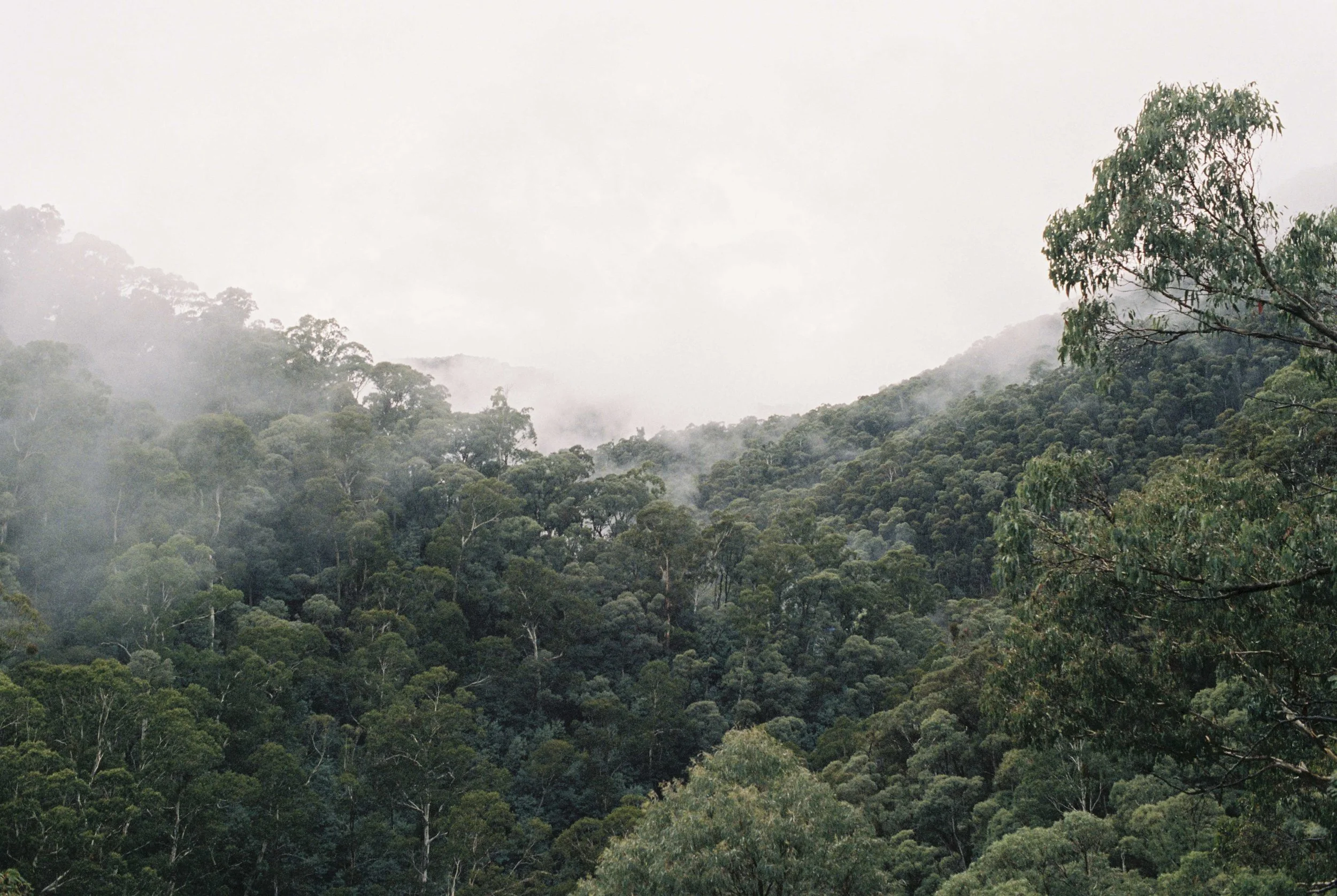
The eucalypt forests were lush on the lower slopes of the Snowies.
We struck out the next day to get up the hill to Dead Horse Gap. We were anticipating a steep and grueling climb.The reality did not end up being as difficult as we anticipated, probably because it was day 20 and our bodies were getting pretty conditioned to riding up long steep hills with our fully loaded panniers. We had also figured out that given sufficient snacks, just about any hill becomes possible. Nevertheless, the first pinch of the climb out of Tom Groggin was along a very steep road, perhaps 10 percent gradient for a solid 2-3km. The road was narrow and steep and the traffic included hundreds of motorbikers, camper trailers, semi-trucks but weirdly, no other cycle tourers. Luckily for us, most of the traffic seemed to be heading the other way.
We gained elevation quickly, especially on the first section of the climb as it took us onto the crest of a ridge which continued up to the shoulder of the Rams Head Range. As we climbed, the eucalypt trees got gradually shorter and soon we had climbed into the cloud layer where all was still, damp and cold. The forest around us had been burnt three years ago, and while the damage was extensive, it was also clear that the forest was regenerating, with new seedlings springing up and epicormic growth clearly visible on the trunks of the eucalypts. The mist swirling around us created a haunting atmosphere…
Snowgums burnt in the 2019 fires.
To be continued…


